
1963 Map of Olustee
USGS Topo · Published 1964About this map
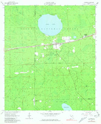
Osceola National Forest dominates this North Florida landscape, punctuated by the nearly circular Ocean Pond and the commemorative grounds of the Olustee Battlefield State Mon. The area reflects a convergence of conservation and historical memory, where the Olustee Experimental Forest sits adjacent to the small settlement of Olustee. Transportation and industry define the central corridor, with the Seaboard Air Line railroad cutting east-to-west past a prominent Lookout Tower and Roadside Park. Genealogical interest is found at Monument Cem and Dyess Cem, situated near the headwaters of Olustee Creek. The southern reaches transition into the heavy wetlands of South Prong Swamp and Palestine Lake, illustrating the drainage patterns of the Baker and Union county borders before modern drainage altered these interior flatwoods.
Find a feature on this map
23 named features on this map. Tap any name to fly to it.
Don’t see what you’re looking for? This feature index may not catch every label — zoom into the map to look around manually.
Map Details
Editions of this 1963 Olustee Map
3 editions found
Other maps of this area

1954 · Valdosta
USGS Topo · 1:250,000

1958 · Valdosta
USGS Topo · 1:250,000

1959 · Valdosta
USGS Topo · 1:250,000

1961 · Deep Creek
USGS Topo · 1:24,000

1962 · Lake City East
USGS Topo · 1:24,000

1963 · Sanderson South
USGS Topo · 1:24,000

1963 · Ellisville
USGS Topo · 1:24,000

1966 · Lake Butler
USGS Topo · 1:24,000
1966 · Lulu
USGS Topo · 1:24,000

1969 · Sanderson North
USGS Topo · 1:24,000