1990s Maps of Columbia County, Florida
Explore 7 historic maps of Columbia County from the 1990s. These maps offer a rare glimpse into what life looked like during the 1990s — showing old roads, neighborhoods, homes, and landmarks that have changed or disappeared over time.
Whether you're researching your family's past, planning a metal detecting trip, or studying how Columbia County's landscape evolved across the 1990s, these high-resolution maps are a powerful tool for exploring the history of this region.
- Focus on a specific era: All maps on this page are from the 1990s, giving you a focused view of this time period.
- See what’s changed: Compare century-old streets, trails, and buildings to today's modern landscape using overlays and satellite layers.
- Research with precision: Use these maps for genealogy, historical research, land use analysis, or educational projects.
- View, download, or print: Maps are fully viewable online in high resolution, and can be downloaded or printed for your own records.
Start exploring Columbia County's history through authentic maps from the 1990s. This is your window into the past.
Columbia County, FL maps
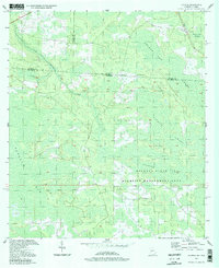
(7)- 1994 Map of Sargent
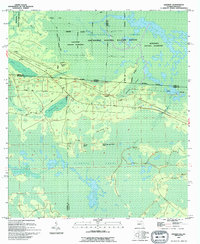 1994 Sargent1994 Print · USGSThe Florida-Georgia borderlands in the mid-nineties are defined here by the great Southern wetlands and the small outposts that edge them. Genealogists and historians can trace the remote settlements of Sargent and Traveler or locate family-named landmarks like Devils Cup and Saucer Island.
 - 1994 Map of Deep Creek, 1995 Print
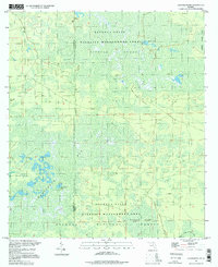
 1994 Deep Creek1995 Print · USGSOsceola National Forest and the wetlands of northern Columbia County are mapped here during the mid-nineties. Trace old forestry routes, a Lookout Tower, and the Old Railroad Grade alongside local settlements like Greenfield and Deep Creek.2 unique versions available
 - 1994 Map of Ellisville, 1998 Print
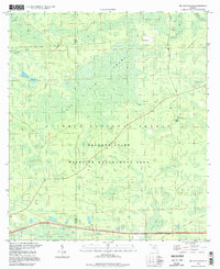
 1994 Ellisville1998 Print · USGSColumbia County in the mid-1990s remains a landscape of quiet rural settlements and winding waterways. Genealogists and local historians can locate many family burial grounds and community landmarks like Hopeful Ch Cemetery, Mt Tabor, and the Rose Creek Lookout Tower.
 - 1994 Map of Fairview, 1998 Print
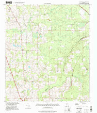
 1994 Fairview1998 Print · USGSColumbia County’s forest and bayou country is captured in the mid-nineties, showing the intersection of managed timberlands and natural wetlands. Trace the path of an Old Railroad Grade or locate historic landmarks like the Benton Lookout Tower and Fairview.
 - 1994 Map of Council, 1998 Print
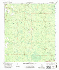
 1994 Council1998 Print · USGSThe Georgia-Florida borderlands come into focus in the 1990s, revealing a landscape defined by the Osceola State Wildlife Management Area. Researchers can trace the historic Watson Line and the winding course of Little Suwannee Creek through the Pinhook Swamp.
 - 1994 Map of Sanderson Nw, 1998 Print
 1994 Sanderson Nw1998 Print · USGSFlorida's northern wetlands are preserved in this mid-nineties survey of the Baker and Columbia County line. Naturalists and local historians can trace the bounds of Impassable Bay and find old industrial sites like Reddish Millsite.
 - 1994 Map of Big Gum Swamp, 1998 Print
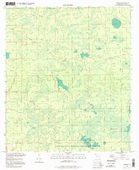
 1994 Big Gum Swamp1998 Print · USGSFlorida's northern interior remains a wild landscape of timber and wetlands in the 1990s. Trace the remote logging and hunting access through Big Gum Swamp, the Osceola National Forest, and the outpost at Seventeenmile Camp.
End of results
Showing maps 1-7 of 7
Top cities of Columbia County
Frequently asked questions
- What are the different types of historical maps available for Columbia County?
- What is the oldest map of Columbia County?
- Where can I purchase historical maps of Columbia County for my home or office?
- Where can I download high-res historical maps of Columbia County?
- Are there historical topographic maps available for Columbia County?
- Is there historical aerial imagery available for Columbia County?
- Where are historical maps of Columbia County sourced from?