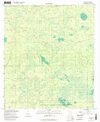
1994 Map of Fairview
USGS Topo · Published 1998About this map
Osceola National Forest and the Osceola State Wildlife Management Area dominate this landscape in Columbia County, characterized by an extensive network of wetlands and pine flatwoods. The map reveals the intricate water patterns of Sandlin Bay, Burnett Bay, and Cowhouse Bay, along with the headwaters of the Little Suwannee. For historians and researchers, the inclusion of an Old Railroad Grade and Old RR Grade cutting through the forest provides clear evidence of the region's earlier timber or turpentine industries, which relied on these now-repurposed corridors for transport. The settlement of Fairview appears as a small node near the intersection of Sand Hill Road and Fairview Road, while the Benton Lookout Tower stands as a notable landmark for fire management in this heavily forested terrain. The abundance of a Firebreak system further emphasizes the managed nature of this landscape.
Find a feature on this map
23 named features on this map. Tap any name to fly to it.
Don’t see what you’re looking for? This feature index may not catch every label — zoom into the map to look around manually.
Map Details
Editions of this 1994 Fairview Map
This is the sole edition of this map. No revisions or reprints were ever made.
Other maps of this area

1954 · Valdosta
USGS Topo · 1:250,000

1955 · Council
USGS Topo · 1:24,000

1955 · Fargo SW
USGS Topo · 1:24,000

1956 · Sargent
USGS Topo · 1:24,000

1958 · Valdosta
USGS Topo · 1:250,000

1959 · Valdosta
USGS Topo · 1:250,000

1961 · Deep Creek
USGS Topo · 1:24,000

1961 · White Springs East
USGS Topo · 1:24,000

1967 · Sargent
USGS Topo · 1:24,000

1969 · Sanderson NW
USGS Topo · 1:24,000