
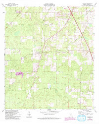
1963 Map of Columbia
USGS Topo · Published 1965About this map
Atlantic Coast Line tracks run north-to-south through this early 1960s landscape, passing through the small community of Columbia. The area is characterized by a high density of rural religious centers, including Mt Salem Ch, Washington Ch, and Mt Sinai Ch, reflecting the deep-rooted social and family structures of Columbia County at this time. To the north, Pleasant Grove Ch and Bethel Ch serve the local population near the banks of Clay Hole Creek.
Find a feature on this map
16 named features on this map. Tap any name to fly to it.
Don’t see what you’re looking for? This feature index may not catch every label — zoom into the map to look around manually.
Map Details
Editions of this 1963 Columbia Map
2 editions found
Other maps of this area

1954 · Gainesville
USGS Topo · 1:250,000

1954 · Valdosta
USGS Topo · 1:250,000

1958 · Valdosta
USGS Topo · 1:250,000

1958 · Gainesville
USGS Topo · 1:250,000

1959 · Valdosta
USGS Topo · 1:250,000

1959 · Gainesville
USGS Topo · 1:250,000

1962 · Lake City East
USGS Topo · 1:24,000

1962 · Mikesville
USGS Topo · 1:24,000

1963 · Ellisville
USGS Topo · 1:24,000

1963 · Lake City West
USGS Topo · 1:24,000