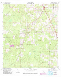
1963 Map of Columbia
USGS Topo · Published 1993About this map
The community of Columbia serves as a central hub in this north Florida landscape, which is defined by an extensive network of country churches that speak to the area's social fabric in the early 1960s. These spiritual landmarks, including Bethel Ch, Mt Sinai Ch, and Jerusalem Ch, are distributed across a terrain of subtle elevation changes and local sinks like Clay Hole. The presence of Community Cem near the center of the settlement provides a clear focal point for genealogical research.
Find a feature on this map
20 named features on this map. Tap any name to fly to it.
Don’t see what you’re looking for? This feature index may not catch every label — zoom into the map to look around manually.
Map Details
Editions of this 1963 Columbia Map
2 editions found
Other maps of this area

1954 · Gainesville
USGS Topo · 1:250,000

1954 · Valdosta
USGS Topo · 1:250,000

1958 · Valdosta
USGS Topo · 1:250,000

1958 · Gainesville
USGS Topo · 1:250,000

1959 · Valdosta
USGS Topo · 1:250,000

1959 · Gainesville
USGS Topo · 1:250,000

1962 · Lake City East
USGS Topo · 1:24,000

1962 · Mikesville
USGS Topo · 1:24,000

1963 · Ellisville
USGS Topo · 1:24,000

1963 · Columbia
USGS Topo · 1:24,000