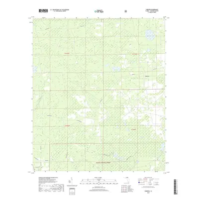
2018 Map of Fairview
USGS Topo · Published 2018About this map
Osceola National Forest dominates the southern landscape of this 2018 survey, reflecting a region defined by its expansive wetlands and forest management. Small settlements like Fairview and Muscogee serve as anchors along a network of rural routes, including Fairview Rd and NE Muscogee Rd. The geography is characterized by several large wetland basins known locally as bays, such as Impassable Bay, Cowhouse Bay, and Sandlin Bay, which dictated the placement of early logging roads and modern forest trails. The presence of the Green Horse Trail suggests the recreational and utilitarian use of these protected woods. Unlike more mountainous regions where elevation dictates development, here the subtle drainage patterns of features like Little Camp Pond and Burnett Bay have historically shaped the limits of habitation and agriculture in Columbia County.
Find a feature on this map
26 named features on this map. Tap any name to fly to it.
Don’t see what you’re looking for? This feature index may not catch every label — zoom into the map to look around manually.
Map Details
Editions of this 2018 Fairview Map
This is the sole edition of this map. No revisions or reprints were ever made.
Other maps of this area

1954 · Valdosta
USGS Topo · 1:250,000

1955 · Council
USGS Topo · 1:24,000

1955 · Fargo SW
USGS Topo · 1:24,000

1956 · Sargent
USGS Topo · 1:24,000

1958 · Valdosta
USGS Topo · 1:250,000

1959 · Valdosta
USGS Topo · 1:250,000

1961 · Deep Creek
USGS Topo · 1:24,000

1961 · White Springs East
USGS Topo · 1:24,000

1967 · Sargent
USGS Topo · 1:24,000

1969 · Sanderson NW
USGS Topo · 1:24,000