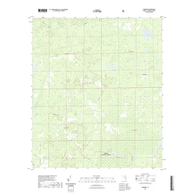
2021 Map of Fairview
USGS Topo · Published 2021About this map
The Osceola National Forest dominates this section of Columbia County, defining a landscape where expansive wetlands and shallow basins shape the local geography. The settlement of Fairview sits at the intersection of Fairview Rd and Sand Hill Rd, surrounded by numerous locally named "bays"—low-lying, swampy depressions typical of the Florida flatwoods. These features, including Sandin Bay, Burnett Bay, and the descriptively named Impassable Bay, indicate the challenging hydrology that historically limited development in this area.
Find a feature on this map
26 named features on this map. Tap any name to fly to it.
Don’t see what you’re looking for? This feature index may not catch every label — zoom into the map to look around manually.
Map Details
Editions of this 2021 Fairview Map
This is the sole edition of this map. No revisions or reprints were ever made.
Other maps of this area

1954 · Valdosta
USGS Topo · 1:250,000

1955 · Council
USGS Topo · 1:24,000

1955 · Fargo SW
USGS Topo · 1:24,000

1956 · Sargent
USGS Topo · 1:24,000

1958 · Valdosta
USGS Topo · 1:250,000

1959 · Valdosta
USGS Topo · 1:250,000

1961 · Deep Creek
USGS Topo · 1:24,000

1961 · White Springs East
USGS Topo · 1:24,000

1967 · Sargent
USGS Topo · 1:24,000

1969 · Sanderson NW
USGS Topo · 1:24,000