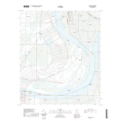
2020 Map of Fairview
USGS Topo · Published 2020About this map
Fairview lies at the heart of a complex riverine landscape where the Mississippi River forms the state boundary between Louisiana and Mississippi. The area is defined by its shifting hydrology, featuring old meanders and cutoffs such as the Old River and Glasscock Cutoff. Large alluvial landforms like Glasscock Island and Fritz Island dominate the center of the sheet, surrounded by extensive wetlands including the Bougere Swamps. The influence of the river is visible in the network of protective embankments, notably the Slocum Levee Rd which skirts the western edge of the main channel.
Find a feature on this map
42 named features on this map. Tap any name to fly to it.
Don’t see what you’re looking for? This feature index may not catch every label — zoom into the map to look around manually.
Map Details
Editions of this 2020 Fairview Map
This is the sole edition of this map. No revisions or reprints were ever made.
Other maps of this area

1936 · Woodville
USGS Topo · 1:62,500

1939 · Kingston
USGS Topo · 1:62,500

1939 · Artonish
USGS Topo · 1:62,500

1939 · Deer Park
USGS Topo · 1:62,500

1953 · Natchez
USGS Topo · 1:250,000

1954 · Artonish
USGS Topo · 1:62,500

1955 · Artonish
USGS Topo · 1:62,500

1956 · Natchez
USGS Topo · 1:250,000

1958 · Artonish
USGS Topo · 1:62,500

1958 · Woodville
USGS Topo · 1:62,500