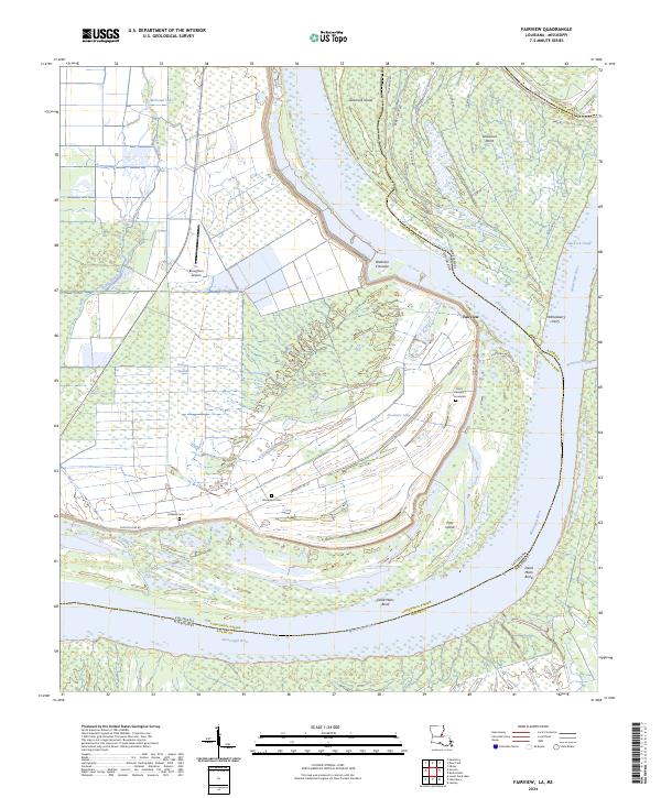
2024 Map of Fairview
USGS Topo · Published 2024About this map
Mississippi River dynamics dominate this landscape along the Louisiana and Mississippi border, where shifting channels have created a complex network of chutes and islands. The community of Fairview sits near the banks of the Old River, a relic of the main river's historical path. Significant landform features like the Brabston Crevasse and Glasscock Cutoff illustrate the power of floodwaters and engineered navigation in this alluvial environment.
Find a feature on this map
37 named features on this map. Tap any name to fly to it.
Don’t see what you’re looking for? This feature index may not catch every label — zoom into the map to look around manually.
Map Details
Editions of this 2024 Fairview Map
This is the sole edition of this map. No revisions or reprints were ever made.
Other maps of this area

1936 · Woodville
USGS Topo · 1:62,500

1939 · Kingston
USGS Topo · 1:62,500

1939 · Artonish
USGS Topo · 1:62,500

1939 · Deer Park
USGS Topo · 1:62,500

1953 · Natchez
USGS Topo · 1:250,000

1954 · Artonish
USGS Topo · 1:62,500

1955 · Artonish
USGS Topo · 1:62,500

1956 · Natchez
USGS Topo · 1:250,000

1958 · Artonish
USGS Topo · 1:62,500

1958 · Woodville
USGS Topo · 1:62,500