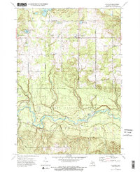
1972 Map of Fairview
USGS Topo · Published 1975About this map
The Au Sable River meanders through the southern half of this Oscoda County landscape, carving a deep valley through the Huron National Forest and Flats terrain. Near the bend in the river, the settlement of Mio is visible alongside the Mio Cem and the Mio Airport. This 1970s survey illustrates a region defined by its timber and transportation history, featuring an Old Railroad grade and a Private Railroad cutting through the center of the sheet. To the north, the community of Fairview serves as a local hub, surrounded by a grid of rural roads like Kneeland Road and Weaver Road. Numerous kettle lakes, including Smith Lake and North Helmer Lake, dot the glacial topography within the Oscoda State Forest, while several Gravel Pits indicate the local extractive industry of the era.
Find a feature on this map
42 named features on this map. Tap any name to fly to it.
Don’t see what you’re looking for? This feature index may not catch every label — zoom into the map to look around manually.
Map Details
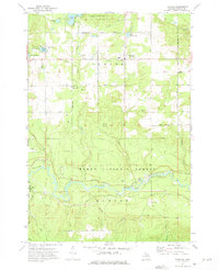
Editions of this 1972 Fairview Map
2 editions found
Other maps of this area

1954 · Traverse City
USGS Topo · 1:250,000

1954 · Tawas City
USGS Topo · 1:250,000

1955 · Comins
USGS Topo · 1:62,500

1958 · Traverse City
USGS Topo · 1:250,000

1958 · Tawas City
USGS Topo · 1:250,000

1972 · McKinley
USGS Topo · 1:24,000

1972 · McCollum Lake
USGS Topo · 1:24,000

1972 · Goodar
USGS Topo · 1:24,000

1972 · Mio
USGS Topo · 1:24,000

1972 · Mack Lake
USGS Topo · 1:24,000
Featured Places
- Mentor Township, MI
- Fairview, Comins Township
- Kneeland, Comins Township
- Comins Township, MI
- Oscoda County, MI