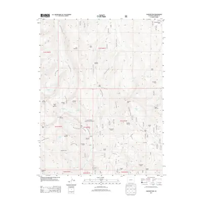
2013 Map of Fairview Peak
USGS Topo · Published 2013About this map
Fairview Peak and the high ridges of the Gunnison National Forest dominate this landscape, which is defined by its network of alpine water bodies and drainage gulches. The terrain is a complex series of peaks and passes, including the notable Gunsight Pass situated between Broncho Mountain and Square Top Mountain. This area serves as a significant watershed, where numerous creeks such as Gold Cr and Lottis Cr originate from high-elevation basins like Lamphier Lake and Henry Lake.
Find a feature on this map
64 named features on this map. Tap any name to fly to it.
Don’t see what you’re looking for? This feature index may not catch every label — zoom into the map to look around manually.
Map Details
Editions of this 2013 Fairview Peak Map
This is the sole edition of this map. No revisions or reprints were ever made.
Other maps of this area

1934 · Taylor Park
USGS Topo · 1:62,500

1937 · Taylor Park
USGS Topo · 1:62,500

1940 · Garfield
USGS Topo · 1:62,500

1941 · Pitkin
USGS Topo · 1:62,500

1945 · Pitkin
USGS Topo · 1:62,500

1945 · Garfield
USGS Topo · 1:62,500

1955 · Mount Harvard
USGS Topo · 1:62,500

1956 · Montrose
USGS Topo · 1:250,000

1959 · Montrose
USGS Topo · 1:250,000

1960 · Montrose
USGS Topo · 1:250,000