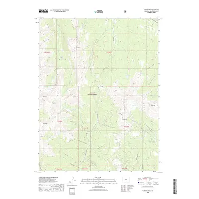
2019 Map of Fairview Peak
USGS Topo · Published 2019About this map
Gunnison National Forest terrain dominates this high-altitude landscape, where numerous glacial cirques and alpine basins define the drainage patterns of Gold Cr and Lottis Cr. The central massif is anchored by Fairview Peak and the aptly named Terrible Mtn, with the high-altitude crossing at Gunsight Pass providing a critical topographical notch between the watersheds. This survey illustrates a complex network of named gulches and canyons, such as Snowslide Gulch and Armstrong Canyon, which speak to the erosive power of mountain runoff.
Find a feature on this map
85 named features on this map. Tap any name to fly to it.
Don’t see what you’re looking for? This feature index may not catch every label — zoom into the map to look around manually.
Map Details
Editions of this 2019 Fairview Peak Map
This is the sole edition of this map. No revisions or reprints were ever made.
Other maps of this area

1934 · Taylor Park
USGS Topo · 1:62,500

1937 · Taylor Park
USGS Topo · 1:62,500

1940 · Garfield
USGS Topo · 1:62,500

1941 · Pitkin
USGS Topo · 1:62,500

1945 · Pitkin
USGS Topo · 1:62,500

1945 · Garfield
USGS Topo · 1:62,500

1955 · Mount Harvard
USGS Topo · 1:62,500

1956 · Montrose
USGS Topo · 1:250,000

1959 · Montrose
USGS Topo · 1:250,000

1960 · Montrose
USGS Topo · 1:250,000