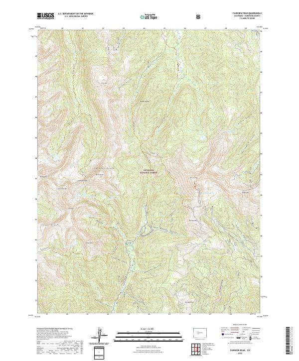
2022 Map of Fairview Peak
USGS Topo · Published 2022About this map
The high-altitude peaks of the Sawatch Range and Fossil Ridge dominate this portion of the Gunnison National Forest. This terrain is defined by a network of drainage basins and glacial features, including several high-elevation bodies of water like Henry Lake, Mill Lake, and the connected Lamphier Lake and Lower Lamphier Lake. The landscape is etched with historical routes and trails such as the Fossil Ridge Trl and Gold Creek Ski Trl, reflecting a long history of wilderness access and recreational use.
Find a feature on this map
59 named features on this map. Tap any name to fly to it.
Don’t see what you’re looking for? This feature index may not catch every label — zoom into the map to look around manually.
Map Details
Editions of this 2022 Fairview Peak Map
This is the sole edition of this map. No revisions or reprints were ever made.
Other maps of this area

1934 · Taylor Park
USGS Topo · 1:62,500

1937 · Taylor Park
USGS Topo · 1:62,500

1940 · Garfield
USGS Topo · 1:62,500

1941 · Pitkin
USGS Topo · 1:62,500

1945 · Pitkin
USGS Topo · 1:62,500

1945 · Garfield
USGS Topo · 1:62,500

1955 · Mount Harvard
USGS Topo · 1:62,500

1956 · Montrose
USGS Topo · 1:250,000

1959 · Montrose
USGS Topo · 1:250,000

1960 · Montrose
USGS Topo · 1:250,000