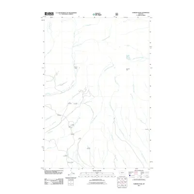
2011 Map of Fairview Peak
USGS Topo · Published 2011About this map
Gilbert Homestead, Cole Homestead, and Bennett Homestead anchor a landscape of historic family claims in this high-altitude section of Park County. The topography is defined by the drainage systems of Rock Creek and West Fork Duck Creek, where early mountain industry is marked by the presence of the Bishir Sawmill near the center of the sheet. This area reflects the late-stage ranching and homesteading patterns of the Montana wilderness, with several remote residences like the Southerd Homestead and Heups Homestead situated along steep-banked tributaries. Recreational use is also evident at the Rock Creek Camp Ground, while the terrain rises sharply toward the namesake Fairview Peak in the northeast. This 2011 survey preserves the specific locations of legacy family tracts and the small-scale timber works that once supported these isolated mountain properties.
Find a feature on this map
33 named features on this map. Tap any name to fly to it.
Don’t see what you’re looking for? This feature index may not catch every label — zoom into the map to look around manually.
Map Details
Editions of this 2011 Fairview Peak Map
This is the sole edition of this map. No revisions or reprints were ever made.
Other maps of this area

1886 · Little Belt Mts.
USGS Topo · 1:250,000

1891 · Livingston
USGS Topo · 1:250,000

1893 · Livingston
USGS Topo · 1:250,000

1894 · Little Belt Mts.
USGS Topo · 1:250,000

1897 · Little Belt Mts.
USGS Topo · 1:250,000

1898 · Little Belt Mts.
USGS Topo · 1:250,000

1902 · Little Belt Mts.
USGS Topo · 1:250,000

1947 · Bozeman
USGS Topo · 1:250,000

1948 · Bozeman
USGS Topo · 1:250,000

1948 · White Sulphur Springs
USGS Topo · 1:250,000