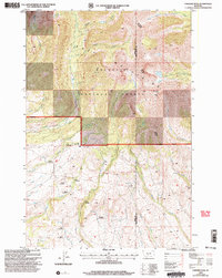
2000 Map of Fairview Peak
USGS Topo · Published 2005About this map
Gallatin National Forest dominates this landscape where the high peaks of the Gallatin Mountains meet an intricate network of homesteads and watercourses. Centered on Fairview Peak, the map captures the transition from alpine terrain to the productive valleys of Big Timber Creek and Duck Creek. The area is defined by a distinct cluster of historical properties, including the Cole Homestead, Gilbert Homestead, and Trainer Homestead, reflecting the early 20th-century ranching and settlement patterns of this region near the boundary of Park and Sweet Grass counties.
Find a feature on this map
34 named features on this map. Tap any name to fly to it.
Don’t see what you’re looking for? This feature index may not catch every label — zoom into the map to look around manually.
Map Details
Editions of this 2000 Fairview Peak Map
This is the sole edition of this map. No revisions or reprints were ever made.
Other maps of this area

1886 · Little Belt Mts.
USGS Topo · 1:250,000

1891 · Livingston
USGS Topo · 1:250,000

1893 · Livingston
USGS Topo · 1:250,000

1894 · Little Belt Mts.
USGS Topo · 1:250,000

1897 · Little Belt Mts.
USGS Topo · 1:250,000

1898 · Little Belt Mts.
USGS Topo · 1:250,000

1902 · Little Belt Mts.
USGS Topo · 1:250,000

1947 · Bozeman
USGS Topo · 1:250,000

1948 · Bozeman
USGS Topo · 1:250,000

1948 · White Sulphur Springs
USGS Topo · 1:250,000