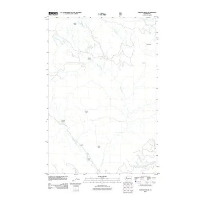
2011 Map of Fairview Ridge
USGS Topo · Published 2011About this map
Fairview Ridge and its surrounding high-country drainages define this portion of Yakima County, where the upper Klickitat River carves a path through the landscape. This 2011 survey illustrates a remote region where water sources like Maiden Springs and Cultus Hole are vital landmarks for navigation and land use. The topography is dominated by dramatic outcrops such as Coyote Rocks and the elevation at Sheep Point.
Find a feature on this map
17 named features on this map. Tap any name to fly to it.
Don’t see what you’re looking for? This feature index may not catch every label — zoom into the map to look around manually.
Map Details
Editions of this 2011 Fairview Ridge Map
This is the sole edition of this map. No revisions or reprints were ever made.
Other maps of this area

1902 · Mount Aix
USGS Topo · 1:125,000

1904 · Mt Aix
USGS Topo · 1:125,000

1904 · Mount Adams
USGS Topo · 1:125,000

1907 · Mount Adams
USGS Topo · 1:125,000

1950 · Yakima
USGS Topo · 1:250,000

1958 · Yakima
USGS Topo · 1:250,000

1961 · Yakima
USGS Topo · 1:250,000

1962 · White Pass
USGS Topo · 1:62,500

1967 · Darland Mtn
USGS Topo · 1:24,000
1967 · Foundation Ridge
USGS Topo · 1:24,000