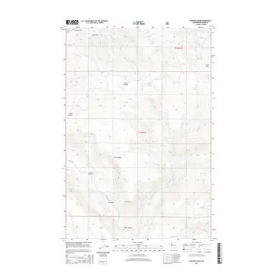
2014 Map of Fairview Ridge
USGS Topo · Published 2014About this map
Fairview Ridge dominates this high-country landscape in Yakima County, where the headwaters of several critical drainages originate. The terrain is defined by a series of meadows and ridges, including Klickitat Meadow and Butte Meadows, which contrast with the sharp verticality of Coyote Rocks and the Klickitat Divide. Historically significant for its seasonal grazing and resource access, the area is navigated by Bureau of Indian Affairs routes like Bia 255 RD.
Find a feature on this map
22 named features on this map. Tap any name to fly to it.
Don’t see what you’re looking for? This feature index may not catch every label — zoom into the map to look around manually.
Map Details
Editions of this 2014 Fairview Ridge Map
This is the sole edition of this map. No revisions or reprints were ever made.
Other maps of this area

1902 · Mount Aix
USGS Topo · 1:125,000

1904 · Mt Aix
USGS Topo · 1:125,000

1904 · Mount Adams
USGS Topo · 1:125,000

1907 · Mount Adams
USGS Topo · 1:125,000

1950 · Yakima
USGS Topo · 1:250,000

1958 · Yakima
USGS Topo · 1:250,000

1961 · Yakima
USGS Topo · 1:250,000

1962 · White Pass
USGS Topo · 1:62,500

1967 · Darland Mtn
USGS Topo · 1:24,000
1967 · Foundation Ridge
USGS Topo · 1:24,000