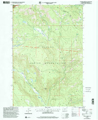
2000 Map of Fairview Ridge
USGS Topo · Published 2001About this map
The Yakama Indian Reservation defines the southeastern geography of this area, where the Klickitat River snakes through the canyon floor. The landscape is characterized by the long spine of Fairview Ridge and the open expanse of Caldwell Prairie. This survey preserves the historical Old Indian Reservation Boundary (Campbell Line 1906-07), a significant demarcation from the early twentieth century that still influenced land management decades later.
Find a feature on this map
24 named features on this map. Tap any name to fly to it.
Don’t see what you’re looking for? This feature index may not catch every label — zoom into the map to look around manually.
Map Details
Editions of this 2000 Fairview Ridge Map
This is the sole edition of this map. No revisions or reprints were ever made.
Other maps of this area

1902 · Mount Aix
USGS Topo · 1:125,000

1904 · Mt Aix
USGS Topo · 1:125,000

1904 · Mount Adams
USGS Topo · 1:125,000

1907 · Mount Adams
USGS Topo · 1:125,000

1950 · Yakima
USGS Topo · 1:250,000

1958 · Yakima
USGS Topo · 1:250,000

1961 · Yakima
USGS Topo · 1:250,000

1962 · White Pass
USGS Topo · 1:62,500

1967 · Darland Mtn
USGS Topo · 1:24,000
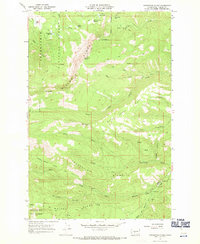
1967 · Foundation Ridge
USGS Topo · 1:24,000