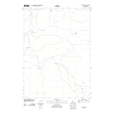
2010 Map of Fairylawn
USGS Topo · Published 2010About this map
Fairylawn serves as a central reference point in this corner of Owyhee County, where the high desert landscape is defined by a sparse but intentional network of ranching outposts and water management. The North Fork Owyhee River carves through the terrain, fed by numerous seasonal drainages like Dougherty Creek and Cottonwood Creek. Human activity is concentrated along the Juniper Mountain Rd, which connects remote locations such as the Lowrey Ranch and Hanley Cabin. Small-scale irrigation and livestock support are evident through features like Forster Reservoir, Foland Dam, and Juniper Creek Dam. Named clearings like Gertrudes Meadow and Peer Field indicate specific sites of historical land use in an area where every named landmark serves as a critical navigational marker. This documentation reflects the enduring ranching character of the Idaho backcountry in the early 21st century.
Find a feature on this map
21 named features on this map. Tap any name to fly to it.
Don’t see what you’re looking for? This feature index may not catch every label — zoom into the map to look around manually.
Map Details
Editions of this 2010 Fairylawn Map
This is the sole edition of this map. No revisions or reprints were ever made.
Other maps of this area

1955 · Jordan Valley
USGS Topo · 1:250,000

1957 · Jordan Valley
USGS Topo · 1:250,000

1958 · Jordan Valley
USGS Topo · 1:250,000

1973 · Smith Creek
USGS Topo · 1:24,000

1973 · Bedstead Ridge
USGS Topo · 1:24,000

1973 · Indian Meadows
USGS Topo · 1:24,000

1973 · Pleasant Valley
USGS Topo · 1:24,000

1973 · Fairylawn
USGS Topo · 1:24,000

1973 · Cliffs
USGS Topo · 1:24,000

1980 · Brewster Reservoir
USGS Topo · 1:24,000