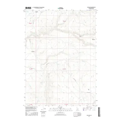
2017 Map of Fairylawn
USGS Topo · Published 2017About this map
Fairylawn and the surrounding high plateau of Owyhee County are defined by the deep drainage of the North Fork Owyhee River and its intricate network of tributaries. In this corner of southwest Idaho, the landscape shifts from the open grazing lands of Gertrudes Meadow to the prominent Pleasant Valley Table. The settlement at Pleasant Valley and the aircraft landing strip at Peer Field indicate the area's ongoing use for remote ranching and land management. Water is the primary driver of names here, from small drainages like Cherry Cr and Dougherty Cr to numerous vital water sources including Peppermint Spring, Mahogany Spring, and Between the Fields Spring. The primary thoroughfare, Juniper Mountain Rd, traverses the township lines of t9s r5w and t10s r5w, connecting these high-desert outposts.
Find a feature on this map
28 named features on this map. Tap any name to fly to it.
Don’t see what you’re looking for? This feature index may not catch every label — zoom into the map to look around manually.
Map Details
Editions of this 2017 Fairylawn Map
This is the sole edition of this map. No revisions or reprints were ever made.
Other maps of this area

1955 · Jordan Valley
USGS Topo · 1:250,000

1957 · Jordan Valley
USGS Topo · 1:250,000

1958 · Jordan Valley
USGS Topo · 1:250,000

1973 · Smith Creek
USGS Topo · 1:24,000

1973 · Bedstead Ridge
USGS Topo · 1:24,000

1973 · Indian Meadows
USGS Topo · 1:24,000

1973 · Pleasant Valley
USGS Topo · 1:24,000

1973 · Fairylawn
USGS Topo · 1:24,000

1973 · Cliffs
USGS Topo · 1:24,000

1980 · Brewster Reservoir
USGS Topo · 1:24,000