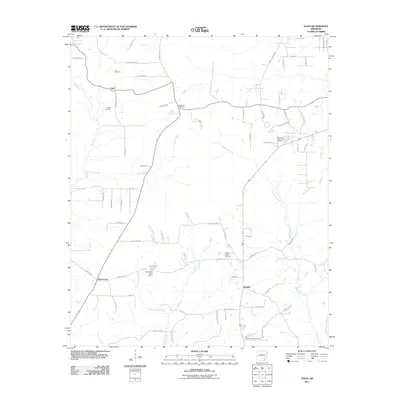
2011 Map of Faith
USGS Topo · Published 2011About this map
Mount Zion and the small settlement of Faith anchor this 2011 survey of southern Cleveland County, characterized by a complex network of creeks and numerous rural burial grounds. The landscape is defined by the winding paths of Cane Creek, Big Creek, and the extensive Hudgens Creek system, which feed into larger local basins like Sandy Bayou. For family historians, the map is remarkably dense with cemeteries, including Curl Cemetery, Blackwell Cemetery, and Pleasant Ridge Cemetery, alongside larger memorial sites such as Rose Lawn Memorial Garden. The southern portion of the quadrangle shows the rural community of Randall and the waters of Studdard Lake, formed by the Studdard Lake Dam. This era of mapping documents the local road network connecting these scattered points of interest, from Gaddy Koonce Rd in the north to Wesley Chapel Cemetery near the southern boundary.
Find a feature on this map
73 named features on this map. Tap any name to fly to it.
Don’t see what you’re looking for? This feature index may not catch every label — zoom into the map to look around manually.
Map Details
Editions of this 2011 Faith Map
This is the sole edition of this map. No revisions or reprints were ever made.
Other maps of this area

1935 · Feenyville
USGS Topo · 1:62,500

1935 · Noble Lake
USGS Topo · 1:62,500

1948 · Helena
USGS Topo · 1:250,000

1950 · Helena
USGS Topo · 1:250,000

1953 · Greenwood
USGS Topo · 1:250,000

1953 · El Dorado
USGS Topo · 1:250,000

1955 · Helena
USGS Topo · 1:250,000

1955 · Little Rock
USGS Topo · 1:250,000

1956 · Little Rock
USGS Topo · 1:250,000

1956 · Greenwood
USGS Topo · 1:250,000