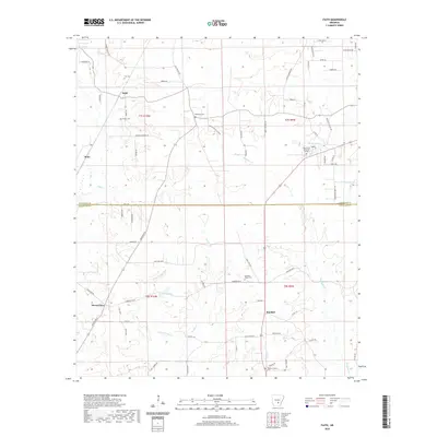
2020 Map of Faith
USGS Topo · Published 2020About this map
Faith and Mount Zion anchor this survey of the South Arkansas interior, where the landscape is defined by the winding drainages of Cane Cr, Sandy Bayou, and Brushy Cr. This 2020 edition reveals a rural network of family-named roads and landmarks along the boundary of Jefferson Co and Cleveland Co. The map is particularly useful for genealogical research, documenting several local burial grounds including Curl Cem, Blackwell Cem, and Pleasant Ridge Cem. Settlement patterns follow the higher ground between the tributaries of Hudgens Cr, with small communities like Randall and Rone connected by local routes such as Gun Club Rd W and Hill Harper Rd. Near the eastern edge, Rose Lawn Memorial Garden and the waters of Rust Lake Number One provide distinct reference points for modern property and historical land use studies.
Find a feature on this map
76 named features on this map. Tap any name to fly to it.
Don’t see what you’re looking for? This feature index may not catch every label — zoom into the map to look around manually.
Map Details
Editions of this 2020 Faith Map
This is the sole edition of this map. No revisions or reprints were ever made.
Other maps of this area

1935 · Feenyville
USGS Topo · 1:62,500

1935 · Noble Lake
USGS Topo · 1:62,500

1948 · Helena
USGS Topo · 1:250,000

1950 · Helena
USGS Topo · 1:250,000

1953 · Greenwood
USGS Topo · 1:250,000

1953 · El Dorado
USGS Topo · 1:250,000

1955 · Helena
USGS Topo · 1:250,000

1955 · Little Rock
USGS Topo · 1:250,000

1956 · Little Rock
USGS Topo · 1:250,000

1956 · Greenwood
USGS Topo · 1:250,000