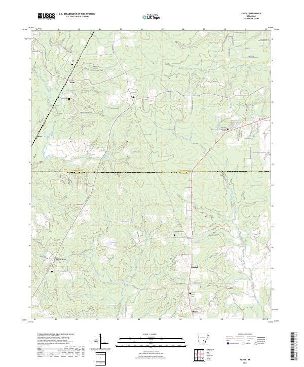
2024 Map of Faith
USGS Topo · Published 2024About this map
Mount Zion and the surrounding timbered lowlands of the Arkansas Coastal Plain define this landscape south of the Jefferson and Cleveland county line. This contemporary survey details a rural network of homesteads and small settlements like Faith and Randall connected by a web of local routes such as Gaddy Koonce Rd and Deer Hunting Club Rd. The terrain is deeply defined by the drainage of Sandy Bayou, Cane Creek, and Brushy Creek, which meander through the forested interior towards larger water bodies like Rust Lake Number One. For genealogists and local historians, the map serves as a precise guide to family landmarks, including Mount Zion Cem, Blackwell Cem, and Rose Lawn Memorial Garden. The persistence of these small communities and burial grounds across the rural landscape offers a clear view of the area's social geography in the twenty-first century.
Find a feature on this map
81 named features on this map. Tap any name to fly to it.
Don’t see what you’re looking for? This feature index may not catch every label — zoom into the map to look around manually.
Map Details
Editions of this 2024 Faith Map
This is the sole edition of this map. No revisions or reprints were ever made.
Other maps of this area

1935 · Feenyville
USGS Topo · 1:62,500

1935 · Noble Lake
USGS Topo · 1:62,500

1948 · Helena
USGS Topo · 1:250,000

1950 · Helena
USGS Topo · 1:250,000

1953 · Greenwood
USGS Topo · 1:250,000

1953 · El Dorado
USGS Topo · 1:250,000

1955 · Helena
USGS Topo · 1:250,000

1955 · Little Rock
USGS Topo · 1:250,000

1956 · Little Rock
USGS Topo · 1:250,000

1956 · Greenwood
USGS Topo · 1:250,000