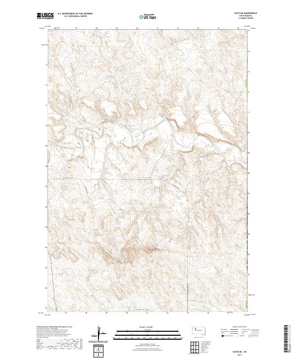
2021 Map of Faith NE
USGS Topo · Published 2021About this map
Arrowhead Butte rises above the Perkins County landscape, serving as a primary landmark in this section of the Great Plains. The winding course of the Moreau River cuts through the center of the quadrangle, joined by several seasonal drainage systems including Locate Cr, Berry Cr, and Mud Cr. This environment is characterized by wide-open ranching land and intermittent watercourses, where the transition between high plains and creek bottoms is marked by features like Badlands Cr. Human presence is sparse and primarily defined by the grid of rural access routes such as Arrowhead Rd and Badlands Rd, which trace the township lines established by the Public Land Survey System. The map documents a contemporary view of this remote South Dakota territory, preserving the exact placement of land boundaries and natural water features.
Find a feature on this map
15 named features on this map. Tap any name to fly to it.
Don’t see what you’re looking for? This feature index may not catch every label — zoom into the map to look around manually.
Map Details
Editions of this 2021 Faith NE Map
This is the sole edition of this map. No revisions or reprints were ever made.
Other maps of this area

1951 · Redelm NW
USGS Topo · 1:24,000

1951 · Faith NE
USGS Topo · 1:24,000

1952 · Faith NW
USGS Topo · 1:24,000

1953 · McIntosh
USGS Topo · 1:250,000

1954 · Lemmon
USGS Topo · 1:250,000

1957 · Lemmon
USGS Topo · 1:250,000

1958 · McIntosh
USGS Topo · 1:250,000

1982 · Glad Valley SW
USGS Topo · 1:24,000
1982 · Red Elm SW
USGS Topo · 1:24,000
1983 · Faith
USGS Topo · 1:24,000