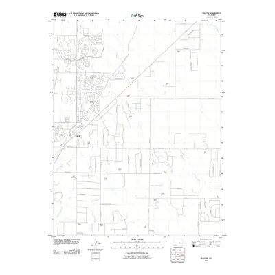
2010 Map of Falcon
USGS Topo · Published 2010About this map
Falcon serves as the primary hub for this portion of the Colorado high plains, situated at the intersection of several regional thoroughfares including Falcon Hwy. The landscape is defined by its transition from open range to modern residential development, with numerous family-named properties like Old Brown Ranch, Bennett Ranch, and Gieck Ranch punctuating the terrain. These ranching legacies are juxtaposed against the expanding grid of newer roads such as Chiming Bell Cir and Londonderry Dr to the northwest.
Find a feature on this map
77 named features on this map. Tap any name to fly to it.
Don’t see what you’re looking for? This feature index may not catch every label — zoom into the map to look around manually.
Map Details
Editions of this 2010 Falcon Map
This is the sole edition of this map. No revisions or reprints were ever made.
Other maps of this area

1893 · Big Springs
USGS Topo · 1:125,000

1893 · Colorado Springs
USGS Topo · 1:125,000

1894 · Castle Rock
USGS Topo · 1:125,000

1909 · Colorado Springs
USGS Topo · 1:125,000

1913 · Castle Rock
USGS Topo · 1:125,000

1940 · Elbert
USGS Topo · 1:62,500

1942 · Colorado Springs
USGS Topo · 1:125,000

1944 · Elbert
USGS Topo · 1:62,500

1948 · Falcon
USGS Topo · 1:24,000

1948 · Falcon
USGS Topo · 1:62,500