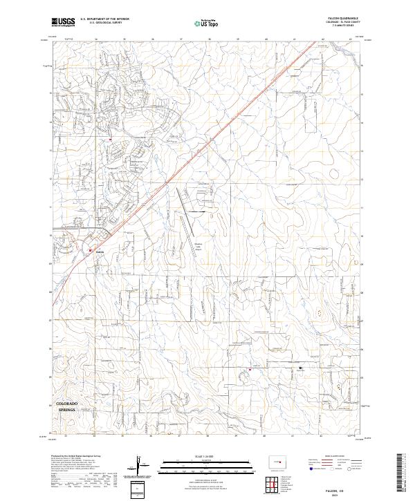
2023 Map of Falcon
USGS Topo · Published 2023About this map
The Falcon community and the northeastern fringes of Colorado Springs anchor this modern topographic study of the El Paso County plains. The landscape is defined by the transition from suburban residential developments to open agricultural and ranch land, structured by a strict rectangular grid of roads including Elbert Rd and Curtis Rd. Central to the area is the Meadow Lake Airport, surrounded by aviation-themed street names like Cessna Dr and Aerostar Dr, reflecting the local importance of private aviation.
Find a feature on this map
177 named features on this map. Tap any name to fly to it.
Don’t see what you’re looking for? This feature index may not catch every label — zoom into the map to look around manually.
Map Details
Editions of this 2023 Falcon Map
This is the sole edition of this map. No revisions or reprints were ever made.
Other maps of this area

1893 · Big Springs
USGS Topo · 1:125,000

1893 · Colorado Springs
USGS Topo · 1:125,000

1894 · Castle Rock
USGS Topo · 1:125,000

1909 · Colorado Springs
USGS Topo · 1:125,000

1913 · Castle Rock
USGS Topo · 1:125,000

1940 · Elbert
USGS Topo · 1:62,500

1942 · Colorado Springs
USGS Topo · 1:125,000

1944 · Elbert
USGS Topo · 1:62,500

1948 · Falcon
USGS Topo · 1:24,000

1948 · Falcon
USGS Topo · 1:62,500