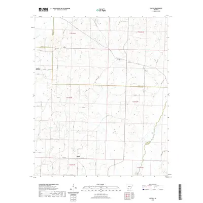
2020 Map of Falcon
USGS Topo · Published 2020About this map
Falcon sits at the heart of this southwest Arkansas landscape, situated along the boundary where Lafayette and Nevada counties meet. The settlement pattern is defined by rural crossroads and family-named landmarks, reflecting a deep-rooted agricultural history. Multiple burial grounds, including Falcon Cem and Clevet Springs Cem, are scattered throughout the region, providing vital points of reference for genealogical research. To the west, Mount Pleasant and Shiloh serve as secondary hubs, connected by a network of county roads like Shiloh Rd.
Find a feature on this map
67 named features on this map. Tap any name to fly to it.
Don’t see what you’re looking for? This feature index may not catch every label — zoom into the map to look around manually.
Map Details
Editions of this 2020 Falcon Map
This is the sole edition of this map. No revisions or reprints were ever made.
Other maps of this area

1901 · Gurdon
USGS Topo · 1:125,000

1951 · Patmos
USGS Topo · 1:24,000

1952 · Old Town
USGS Topo · 1:24,000

1952 · Lewisville
USGS Topo · 1:24,000

1953 · El Dorado
USGS Topo · 1:250,000

1957 · El Dorado
USGS Topo · 1:250,000

1958 · El Dorado
USGS Topo · 1:250,000

1960 · El Dorado
USGS Topo · 1:250,000

1968 · Buckner
USGS Topo · 1:24,000

1968 · Lamartine
USGS Topo · 1:24,000