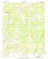
1968 Map of Falcon
USGS Topo · Published 1969About this map
Falcon serves as a central point in this late-1960s survey of southern Arkansas, where the landscape is defined by the intersection of rural agriculture and a growing energy economy. The presence of the Falcon Oil and Gas Field and the Shiloh Oil and Gas Field indicates the subsurface industrial activity that shaped the region's mid-century development. In the southwestern corner, the Shiloh Lookout Tower stands as a notable landmark overlooking a terrain transition between Stamps and Hadley.
Find a feature on this map
42 named features on this map. Tap any name to fly to it.
Don’t see what you’re looking for? This feature index may not catch every label — zoom into the map to look around manually.
Map Details
Editions of this 1968 Falcon Map
This is the sole edition of this map. No revisions or reprints were ever made.
Other maps of this area

1901 · Gurdon
USGS Topo · 1:125,000

1951 · Patmos
USGS Topo · 1:24,000

1952 · Old Town
USGS Topo · 1:24,000

1952 · Lewisville
USGS Topo · 1:24,000

1953 · El Dorado
USGS Topo · 1:250,000

1957 · El Dorado
USGS Topo · 1:250,000

1958 · El Dorado
USGS Topo · 1:250,000

1960 · El Dorado
USGS Topo · 1:250,000

1968 · Buckner
USGS Topo · 1:24,000

1968 · Lamartine
USGS Topo · 1:24,000