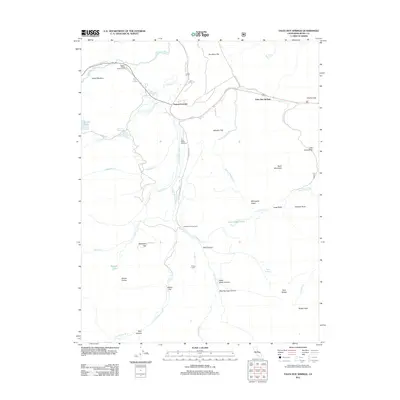
2012 Map of Fales Hot Springs
USGS Topo · Published 2012About this map
Fales Hot Springs and Sonora Junction anchor this high-elevation landscape in Mono County, where the W Walker River and Little Walker River converge. The terrain is characterized by broad flats and meadows, such as Pickel Meadow and Burcham Flat, which contrast with the surrounding peaks like Mount Emma and Rickey Peak. This 2012 survey illustrates a landscape primarily managed for recreation and resource conservation, featuring several established campsites including the Sonora Bridge Campground, Little Walker Cowcamp, and Obsidian Campground. Water is a defining element of the area, with numerous alpine lakes and creeks including Kirman Lake, Emma Lake, and the spring-fed Long Valley Ponds. The map also captures remnants of local history and seasonal habitation through features like the Rickey Cabin and Stockade Flat, providing a detailed record of the roads and watercourses that have historically dictated movement through these mountain passes.
Find a feature on this map
44 named features on this map. Tap any name to fly to it.
Don’t see what you’re looking for? This feature index may not catch every label — zoom into the map to look around manually.
Map Details
Editions of this 2012 Fales Hot Springs Map
This is the sole edition of this map. No revisions or reprints were ever made.
Other maps of this area

1896 · Dardanelles
USGS Topo · 1:125,000

1898 · Dardanelles
USGS Topo · 1:125,000

1909 · Bridgeport
USGS Topo · 1:125,000

1911 · Bridgeport
USGS Topo · 1:125,000

1920 · Bridgeport
USGS Topo · 1:125,000

1948 · Walker Lake
USGS Topo · 1:250,000

1954 · Chris Flat
USGS Topo · 1:24,000

1954 · Pickel Meadow
USGS Topo · 1:24,000

1954 · Fales Hot Springs
USGS Topo · 1:24,000

1954 · Lost Cannon Peak
USGS Topo · 1:24,000