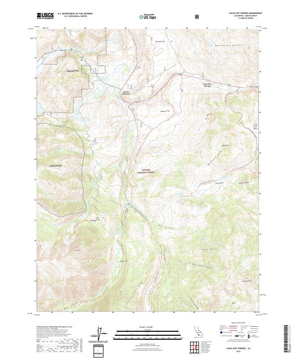
2022 Map of Fales Hot Springs
USGS Topo · Published 2022About this map
Fales Hot Springs and the strategic intersection at Sonora Junction anchor this high-altitude landscape in the eastern Sierra Nevada. The topography is defined by the steep transition from the Sweetwater Mountains in the northeast to the massive prominence of Mt Emma and Rickey Peak in the south. This area, largely contained within the Toiyabe National Forest, serves as a critical drainage basin where the West Walker River and Little Walker River converge. Localized water features like Tule Lake, Emma Lake, and Junction Reservoir provide essential landmarks for navigation. Historically, the terrain is marked by seasonal grazing sites and camps such as Willow Flat and Stockade Flat, connected by a network of trails including the Molybdenite Creek Trl and the Burt Canyon Trl.
Find a feature on this map
52 named features on this map. Tap any name to fly to it.
Don’t see what you’re looking for? This feature index may not catch every label — zoom into the map to look around manually.
Map Details
Editions of this 2022 Fales Hot Springs Map
This is the sole edition of this map. No revisions or reprints were ever made.
Other maps of this area

1896 · Dardanelles
USGS Topo · 1:125,000

1898 · Dardanelles
USGS Topo · 1:125,000

1909 · Bridgeport
USGS Topo · 1:125,000

1911 · Bridgeport
USGS Topo · 1:125,000

1920 · Bridgeport
USGS Topo · 1:125,000

1948 · Walker Lake
USGS Topo · 1:250,000

1954 · Chris Flat
USGS Topo · 1:24,000

1954 · Pickel Meadow
USGS Topo · 1:24,000

1954 · Fales Hot Springs
USGS Topo · 1:24,000

1954 · Lost Cannon Peak
USGS Topo · 1:24,000