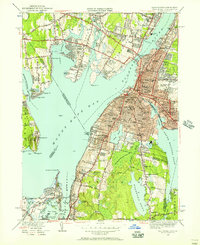
1949 Map of Fall River
USGS Topo · Published 1957About this map
Fall River dominates the landscape as a dense industrial and maritime hub along the Taunton River, while the surrounding rural reaches of Swansea and Tiverton reveal a network of schools and family settlements. The city's mid-century footprint is defined by institutions like St Patricks Cem, Oak Grove Cemetery, and numerous parochial schools including St Johns Sch. Transport is anchored by the New York New Haven and Hartford RR and critical crossings such as the Slades Ferry Bridge and Brightman St Bridge.
Find a feature on this map
118 named features on this map. Tap any name to fly to it.
Don’t see what you’re looking for? This feature index may not catch every label — zoom into the map to look around manually.
Map Details
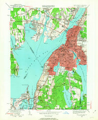
Editions of this 1949 Fall River Map
2 editions found
Other maps of this area

1885 · Taunton
USGS Topo · 1:62,500

1887 · Providence
USGS Topo · 1:62,500

1888 · Fall River
USGS Topo · 1:62,500

1888 · Taunton
USGS Topo · 1:62,500

1889 · Providence
USGS Topo · 1:62,500

1890 · Narragansett Bay
USGS Topo · 1:62,500

1892 · Narragansett Bay
USGS Topo · 1:62,500

1893 · Taunton
USGS Topo · 1:62,500

1893 · Fall River
USGS Topo · 1:62,500

1894 · Providence
USGS Topo · 1:62,500