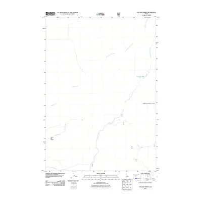
2011 Map of Fallert Springs
USGS Topo · Published 2011About this map
Pass Creek Lake sits as a central water feature in this high-altitude landscape where the headwaters of several drainages diverge. The drainage patterns are clearly defined by the Middle Fork Pass Creek and South Fork Pass Creek, which carve through the terrain near notable landmarks like Middle Fork Eightmile Canyon. This 2011 survey by the U.S. Geological Survey captures a sparsely settled region of Idaho, characterized by deep canyons such as Sunny Bar Canyon and a network of Forest Service or local access roads including 157 and 802. The mapping detail focuses heavily on the intricate hydrography of the area, tracing the winding paths of Boulder Creek, Rocky Run Creek, and Uncle Ike Creek as they navigate the basin.
Find a feature on this map
12 named features on this map. Tap any name to fly to it.
Don’t see what you’re looking for? This feature index may not catch every label — zoom into the map to look around manually.
Map Details
Editions of this 2011 Fallert Springs Map
This is the sole edition of this map. No revisions or reprints were ever made.
Other maps of this area

1955 · Dubois
USGS Topo · 1:250,000

1955 · Idaho Falls
USGS Topo · 1:250,000

1957 · Diamond Peak
USGS Topo · 1:62,500

1958 · Dubois
USGS Topo · 1:250,000

1958 · Idaho Falls
USGS Topo · 1:250,000

1969 · Eightmile Canyon
USGS Topo · 1:24,000

1969 · Tyler Peak
USGS Topo · 1:24,000

1969 · Howe NW
USGS Topo · 1:24,000

1969 · Howe NE
USGS Topo · 1:24,000
1969 · Blue Dome
USGS Topo · 1:24,000