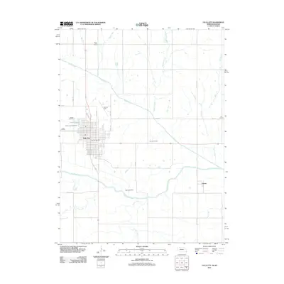
2011 Map of Falls City
USGS Topo · Published 2011About this map
Falls City serves as the focal point of this Richardson County landscape, situated where the high ground meets the fertile valley of the Big Nemaha River. The town's layout is well-defined, anchored by the Falls City Post Office and bordered to the north by Stanton Lake and the Stanton Lake Campground. A series of burial grounds, including the Falls City Cemetery and Steele Cemetery, ring the community, providing significant points of interest for genealogists tracing local families. To the east, the smaller settlement of Preston is tucked between the river and the path of the Dustless Hwy. The surrounding terrain is heavily influenced by a network of waterways like Muddy Creek and Silver Creek, while aviation history is represented by Brenner Field north of the main township.
Find a feature on this map
32 named features on this map. Tap any name to fly to it.
Don’t see what you’re looking for? This feature index may not catch every label — zoom into the map to look around manually.
Map Details
Editions of this 2011 Falls City Map
This is the sole edition of this map. No revisions or reprints were ever made.
Other maps of this area

1885 · Atchison
USGS Topo · 1:125,000

1888 · Atchison
USGS Topo · 1:125,000

1888 · Hiawatha
USGS Topo · 1:125,000

1893 · Atchison
USGS Topo · 1:125,000

1894 · Hiawatha
USGS Topo · 1:125,000

1915 · Falls City
USGS Topo · 1:62,500

1920 · Craig
USGS Topo · 1:62,500

1950 · Kansas City
USGS Topo · 1:250,000

1954 · Kansas City
USGS Topo · 1:250,000

1955 · Nebraska City
USGS Topo · 1:250,000