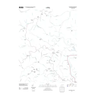
2013 Map of Fallsburg
USGS Topo · Published 2013About this map
The E Fork Little Sandy River and its myriad tributaries carve a complex landscape of hollows and ridges here in Lawrence County. Small communities like Fallsburg, Stringtown, and Yatesville serve as local hubs along a network of winding roads, many following the creek beds. The map reveals deep-rooted family and local history through its named topography, including Jerry Riffe Hill, Miller Hill, and Grubb Bend.
Find a feature on this map
151 named features on this map. Tap any name to fly to it.
Don’t see what you’re looking for? This feature index may not catch every label — zoom into the map to look around manually.
Map Details
Editions of this 2013 Fallsburg Map
This is the sole edition of this map. No revisions or reprints were ever made.
Other maps of this area

1901 · Ceredo
USGS Topo · 1:62,500

1903 · Kenova
USGS Topo · 1:125,000

1904 · Kenova
USGS Topo · 1:125,000

1911 · Louisa
USGS Topo · 1:48,000

1913 · Ceredo
USGS Topo · 1:62,500

1913 · Louisa
USGS Topo · 1:62,500

1939 · Louisa
USGS Topo · 1:62,500
1953 · Prichard
USGS Topo · 1:24,000

1953 · Rush
USGS Topo · 1:24,000

1953 · Boltsfork
USGS Topo · 1:24,000