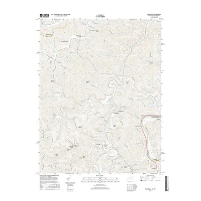
2016 Map of Fallsburg
USGS Topo · Published 2016About this map
Fallsburg and the winding Blaine Creek anchor this landscape in Lawrence County, situated near the confluence of the Big Sandy River and the West Virginia border. The map documents a deeply dissected terrain characterized by numerous family-named hollows and hills, including Hobart Carter Workman Hollow, Jim Carter Hollow, and Jerry Riffe Hill. These names offer a direct connection to the local families who have inhabited these valleys for generations.
Find a feature on this map
142 named features on this map. Tap any name to fly to it.
Don’t see what you’re looking for? This feature index may not catch every label — zoom into the map to look around manually.
Map Details
Editions of this 2016 Fallsburg Map
This is the sole edition of this map. No revisions or reprints were ever made.
Other maps of this area

1901 · Ceredo
USGS Topo · 1:62,500

1903 · Kenova
USGS Topo · 1:125,000

1904 · Kenova
USGS Topo · 1:125,000

1911 · Louisa
USGS Topo · 1:48,000

1913 · Ceredo
USGS Topo · 1:62,500

1913 · Louisa
USGS Topo · 1:62,500

1939 · Louisa
USGS Topo · 1:62,500
1953 · Prichard
USGS Topo · 1:24,000

1953 · Rush
USGS Topo · 1:24,000

1953 · Boltsfork
USGS Topo · 1:24,000