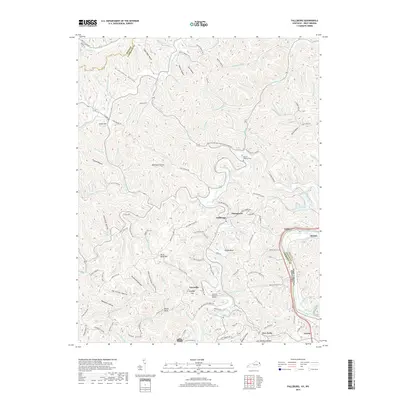
2019 Map of Fallsburg
USGS Topo · Published 2019About this map
Fallsburg and Stringtown anchor this detailed landscape in eastern Kentucky, where the Big Sandy River forms the state boundary with West Virginia. The terrain is characterized by a dense network of named hollows and branches, such as Grannyham Hollow and Deerfield Hollow, illustrating the intricate drainage patterns of Lawrence Co. Significant local landmarks include Raven Rock and Jerry Riffe Hill, while family history is preserved at the Patton Memorial Cem and Yatesville Memorial Gardens. The settlement at Yatesville lies near Bradley Gap, connected by a web of rural routes like Seedtick Rd and Old Fallsburg Rd. This 2019 survey documents the modern layout of these river valley communities just north of Louisa, capturing the area's transition from the creek-bottom farms to the higher ridges.
Find a feature on this map
132 named features on this map. Tap any name to fly to it.
Don’t see what you’re looking for? This feature index may not catch every label — zoom into the map to look around manually.
Map Details
Editions of this 2019 Fallsburg Map
This is the sole edition of this map. No revisions or reprints were ever made.
Other maps of this area

1901 · Ceredo
USGS Topo · 1:62,500

1903 · Kenova
USGS Topo · 1:125,000

1904 · Kenova
USGS Topo · 1:125,000

1911 · Louisa
USGS Topo · 1:48,000

1913 · Ceredo
USGS Topo · 1:62,500

1913 · Louisa
USGS Topo · 1:62,500

1939 · Louisa
USGS Topo · 1:62,500
1953 · Prichard
USGS Topo · 1:24,000

1953 · Rush
USGS Topo · 1:24,000

1953 · Boltsfork
USGS Topo · 1:24,000