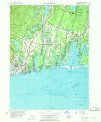
1957 Map of Falmouth
USGS Topo · Published 1969About this map
Falmouth and its surrounding coastal villages are depicted here during a period of mid-century development, where traditional Cape Cod industries like Cranberry Bogs still sat adjacent to growing residential neighborhoods. The landscape is defined by its glacial kettle ponds and finger-like coastal inlets, including Great Pond, Green Pond, and Bournes Pond, which stretch toward the Vineyard Sound. These waterways created a series of peninsulas or necks, such as Acapesket and Seacoast Shores, which were rapidly being subdivided for housing by the late 1950s.
Find a feature on this map
106 named features on this map. Tap any name to fly to it.
Don’t see what you’re looking for? This feature index may not catch every label — zoom into the map to look around manually.
Map Details
Editions of this 1957 Falmouth Map
3 editions found
Other maps of this area

1886 · Falmouth
USGS Topo · 1:62,500

1887 · Marthas Vineyard
USGS Topo · 1:62,500

1888 · Barnstable
USGS Topo · 1:62,500

1888 · Falmouth
USGS Topo · 1:62,500

1889 · Marthas Vineyard
USGS Topo · 1:62,500

1893 · Barnstable
USGS Topo · 1:62,500

1893 · Falmouth
USGS Topo · 1:62,500

1894 · Marthas Vineyard
USGS Topo · 1:62,500

1915 · Falmouth
USGS Topo · 1:62,500

1920 · Falmouth
USGS Topo · 1:62,500