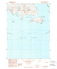
1989 Map of False Pass C-4
USGS Topo · Published 1989About this map
Unimak Island and the jagged southern coastline of the Ikatan Peninsula dominate this late-century survey of the Aleutian chain. The landscape is defined by the Aleutian Islands Wilderness, where the terrain rises sharply from the sea to elevations like Dora Peak. The coastline is heavily indented with natural harbors, including the sheltered waters of Dora Harbor, West Anchor Cove, and East Anchor Cove, which provide refuge from the surrounding Pacific Ocean and Otter Cove. At the southeastern extremity, Cape Pankof is marked by a light and surrounded by maritime hazards like Pankof Breaker and Pinnacle. This map documents a remote stretch of the Aleutians East Borough as it appeared in the late 1980s, focusing on the topographic relief and nautical landmarks of this uninhabited wilderness area.
Find a feature on this map
17 named features on this map. Tap any name to fly to it.
Don’t see what you’re looking for? This feature index may not catch every label — zoom into the map to look around manually.
Map Details
Editions of this 1989 False Pass C-4 Map
This is the sole edition of this map. No revisions or reprints were ever made.
Other maps of this area

1949 · False Pass
USGS Topo · 1:250,000

1950 · False Pass
USGS Topo · 1:250,000
1963 · False Pass D-3
USGS Topo · 1:63,360
1989 · False Pass B-3
USGS Topo · 1:63,360
1989 · False Pass C-5
USGS Topo · 1:63,360
1995 · False Pass D-5
USGS Topo · 1:63,360
1995 · False Pass D-4
USGS Topo · 1:63,360

2020 · False Pass C-5 SE
USGS Topo · 1:25,000

2020 · False Pass C-3 SW
USGS Topo · 1:25,000

2020 · False Pass C-3 NW
USGS Topo · 1:25,000