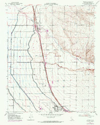
1953 Map of Famoso
USGS Topo · Published 1970About this map
The Southern Pacific railroad corridor serves as the primary spine of development in this San Joaquin Valley landscape, connecting the clustered settlements of Famoso, Slater, and Cawelo. Agricultural engineering is the dominant theme of the terrain, defined by a complex network of irrigation infrastructure including the Friant-Kern Canal, Lerdo Canal, and Calloway Canal which divert water across the plains. These man-made channels contrast with the natural meandering course of Poso Creek as it flows toward the valley floor.
Find a feature on this map
25 named features on this map. Tap any name to fly to it.
Don’t see what you’re looking for? This feature index may not catch every label — zoom into the map to look around manually.
Map Details
Editions of this 1953 Famoso Map
3 editions found
Other maps of this area

1906 · Bakersfield
USGS Topo · 1:62,500

1910 · Buena Vista Lake
USGS Topo · 1:125,000

1912 · Buena Vista Lake
USGS Topo · 1:125,000

1927 · McFarland
USGS Topo · 1:31,680

1930 · McFarland
USGS Topo · 1:31,680

1930 · Wasco
USGS Topo · 1:31,680

1930 · Pond
USGS Topo · 1:31,680

1930 · Famoso
USGS Topo · 1:31,680

1930 · Rosedale
USGS Topo · 1:31,680

1930 · Oildale
USGS Topo · 1:31,680