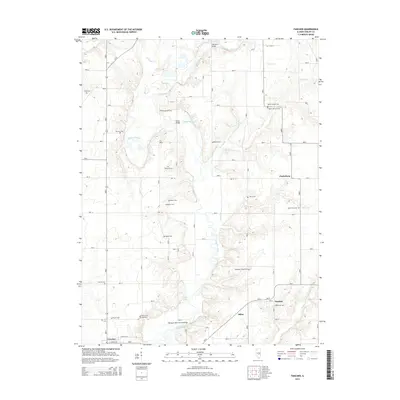
2015 Map of Fancher
USGS Topo · Published 2015About this map
The Kaskaskia River meanders through this portion of Shelby County, creating a landscape defined by its deep bends and the numerous small tributaries like Robinson Cr and Howe Cr that feed into it. This 2015 survey highlights a dense concentration of local family and community history, evidenced by nearly twenty named burial grounds scattered across the terrain, including Mount Hermon Cem, Gallagher Chapel Cem, and Walker Cem. A notable landmark is the Thompson Mill Covered Bridge, which spans the river south of Askins Lake. The settlement patterns here remain tied to the river and the road network connecting Fancher, Clarksburg, and the outskirts of Cowden. These small communities and rural crossings, such as Moore Bridge and Copeland Bridge, illustrate a long-standing reliance on the river's path for local navigation and regional identity.
Find a feature on this map
35 named features on this map. Tap any name to fly to it.
Don’t see what you’re looking for? This feature index may not catch every label — zoom into the map to look around manually.
Map Details
Editions of this 2015 Fancher Map
This is the sole edition of this map. No revisions or reprints were ever made.
Other maps of this area

1941 · St. Elmo
USGS Topo · 1:62,500

1942 · Shelbyville
USGS Topo · 1:62,500

1945 · St. Elmo
USGS Topo · 1:62,500

1946 · Shelbyville
USGS Topo · 1:62,500

1947 · Stewardson
USGS Topo · 1:62,500

1949 · Stewardson
USGS Topo · 1:62,500

1950 · Effingham
USGS Topo · 1:62,500

1951 · Effingham
USGS Topo · 1:62,500

1958 · Decatur
USGS Topo · 1:250,000

1961 · Decatur
USGS Topo · 1:250,000