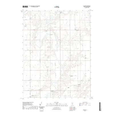
2021 Map of Fancher
USGS Topo · Published 2021About this map
Fancher and the surrounding Shelby County farmland are defined by the winding course of the Kaskaskia River, which bisects the landscape alongside its numerous tributaries like Richland Cr and Robinson Cr. This recent 2021 survey reveals a territory dense with family and community history, evidenced by more than a dozen documented burial sites, including the Gallagher Chapel Cem, Mount Carmel Cem, and Pleasant Hill Cem. The southern edge of the map features the village of Cowden, where the grid of E William ST and Grand Ave meets the rural landscape. Notable river crossings such as the Thompson Mill Covered Bridge and Moore Bridge emphasize the historically significant role of the river in local transit and industry. The distribution of small settlements like Milne and isolated landmarks like Mount Hermon Ch suggests a persistent, decentralized agrarian community that has maintained its layout and local identifiers well into the twenty-first century.
Find a feature on this map
39 named features on this map. Tap any name to fly to it.
Don’t see what you’re looking for? This feature index may not catch every label — zoom into the map to look around manually.
Map Details
Editions of this 2021 Fancher Map
This is the sole edition of this map. No revisions or reprints were ever made.
Other maps of this area

1941 · St. Elmo
USGS Topo · 1:62,500

1942 · Shelbyville
USGS Topo · 1:62,500

1945 · St. Elmo
USGS Topo · 1:62,500

1946 · Shelbyville
USGS Topo · 1:62,500

1947 · Stewardson
USGS Topo · 1:62,500

1949 · Stewardson
USGS Topo · 1:62,500

1950 · Effingham
USGS Topo · 1:62,500

1951 · Effingham
USGS Topo · 1:62,500

1958 · Decatur
USGS Topo · 1:250,000

1961 · Decatur
USGS Topo · 1:250,000