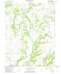
1981 Map of Fancher
USGS Topo · Published 1982About this map
The Kaskaskia River snakes through the heart of Shelby County, creating a deeply dissected landscape where woodland and agriculture meet. This early 1980s landscape is defined by its rural infrastructure, featuring the historic Thompson Mill Covered Bridge and other vital crossings like Moore Bridge and Copeland Bridge. The settlement of Fancher sits at a rail junction between the Norfolk and Western and the Baltimore and Ohio railroads, reflecting the transportation network that once sustained these small agricultural communities.
Find a feature on this map
49 named features on this map. Tap any name to fly to it.
Don’t see what you’re looking for? This feature index may not catch every label — zoom into the map to look around manually.
Map Details
Editions of this 1981 Fancher Map
This is the sole edition of this map. No revisions or reprints were ever made.
Other maps of this area

1941 · St. Elmo
USGS Topo · 1:62,500

1942 · Shelbyville
USGS Topo · 1:62,500

1945 · St. Elmo
USGS Topo · 1:62,500

1946 · Shelbyville
USGS Topo · 1:62,500

1947 · Stewardson
USGS Topo · 1:62,500

1949 · Stewardson
USGS Topo · 1:62,500

1950 · Effingham
USGS Topo · 1:62,500

1951 · Effingham
USGS Topo · 1:62,500

1958 · Decatur
USGS Topo · 1:250,000

1961 · Decatur
USGS Topo · 1:250,000