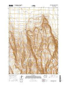
2017 Map of Fandango Canyon
USGS Topo · Published 2017About this map
Christmas Lake Valley defines the northeastern reaches of this high desert terrain, where a grid of rural roads like Cascad Ln and Fermac Rd meets the rising elevations of the Oregon interior. The landscape is characterized by a series of high points and depressions that manage scarce water resources, centered around Saint Patrick Mountain and Juniper Top. The presence of numerous man-made water catchments, including Saint Patrick Mountain Reservoir Number 4, O'Leary Reservoir Number 4, and Horse Corral Reservoir, illustrates the vital infrastructure required for ranching and land management in this arid environment. To the north, the terrain drops into Fandango Canyon, while natural features like Post Lake and Ward Lake offer seasonal water sources. This 2017 survey provides a clear look at the intersection of local transportation routes like Christmas Valley Hwy and the cattle-driven economy indicated by names such as Ripper Waterhole.
Find a feature on this map
32 named features on this map. Tap any name to fly to it.
Don’t see what you’re looking for? This feature index may not catch every label — zoom into the map to look around manually.
Map Details
Editions of this 2017 Fandango Canyon Map
This is the sole edition of this map. No revisions or reprints were ever made.
Other maps of this area

1955 · Crescent
USGS Topo · 1:250,000

1957 · Crescent
USGS Topo · 1:250,000

1958 · Crescent
USGS Topo · 1:250,000

1970 · Crescent
USGS Topo · 1:250,000

1981 · Fossil Lake
USGS Topo · 1:24,000

1982 · Christmas Lake
USGS Topo · 1:24,000
1983 · Crack-in-the-Ground
USGS Topo · 1:24,000

1986 · St. Patrick Mtn.
USGS Topo · 1:24,000
1986 · Christmas Valley
USGS Topo · 1:24,000
1986 · Sheeplick Draw
USGS Topo · 1:24,000