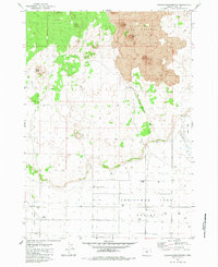
1983 Map of Crack-in-the-Ground
USGS Topo · Published 1983About this map
The volcanic landscape of Central Oregon dominates this survey, centered on the Four Craters Lava Field and the remarkable geologic rift known as Crack in the Ground. The transition from the igneous formations of the north into the wide expanses of Fort Rock Valley and Christmas Lake Valley defines the local topography. This 1980s data reflects a desert environment where water management is the primary marker of human activity, evidenced by a network of isolated wells such as Sprague Well and the named locality at Bowman Wells. While a Picnic Area near the main fissure suggests recreational use, much of the terrain remains accessible only via scattered 4wd tracks that navigate around Reed Rock and across the Alkali Flat. The map effectively captures the stark divide between the ancient lava flows and the basin-and-range valley floors.
Find a feature on this map
11 named features on this map. Tap any name to fly to it.
Don’t see what you’re looking for? This feature index may not catch every label — zoom into the map to look around manually.
Map Details
Editions of this 1983 Crack-in-the-Ground Map
This is the sole edition of this map. No revisions or reprints were ever made.
Other maps of this area

1955 · Crescent
USGS Topo · 1:250,000

1957 · Crescent
USGS Topo · 1:250,000

1958 · Crescent
USGS Topo · 1:250,000

1970 · Crescent
USGS Topo · 1:250,000

1981 · Hogback Butte
USGS Topo · 1:24,000

1981 · Thorn Lake
USGS Topo · 1:24,000

1981 · Lane Lake
USGS Topo · 1:24,000

1982 · Peters Creek Sink
USGS Topo · 1:24,000

1982 · Christmas Lake
USGS Topo · 1:24,000

1982 · Jacks Place
USGS Topo · 1:24,000