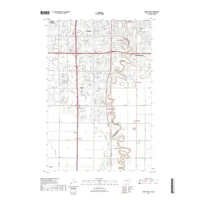
2018 Map of Fargo South
USGS Topo · Published 2018About this map
The Red River of the North winds through this urban and suburban landscape, serving as the definitive border between Fargo, North Dakota, and Moorhead, Minnesota. This 2018 survey documents a region of significant educational and civic infrastructure, featuring institutions like Minnesota State University Moorhead, Concordia College, and the Rasmussen College-Fargo Campus. The area's development is structured by a dense network of transit corridors, including Interstate 29 and Interstate 94, alongside the industrial presence of the BNSF Railway.
Find a feature on this map
37 named features on this map. Tap any name to fly to it.
Don’t see what you’re looking for? This feature index may not catch every label — zoom into the map to look around manually.
Map Details
Editions of this 2018 Fargo South Map
This is the sole edition of this map. No revisions or reprints were ever made.
Other maps of this area

1895 · Fargo
USGS Topo · 1:125,000

1897 · Fargo
USGS Topo · 1:125,000

1953 · Fargo
USGS Topo · 1:250,000

1956 · Fargo
USGS Topo · 1:250,000

1959 · Fargo North
USGS Topo · 1:24,000

1959 · South West Fargo
USGS Topo · 1:24,000

1959 · Fargo South
USGS Topo · 1:24,000

1959 · Hickson
USGS Topo · 1:24,000

1959 · West Fargo
USGS Topo · 1:24,000
1959 · Norman
USGS Topo · 1:24,000