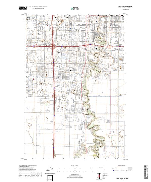
2024 Map of Fargo South
USGS Topo · Published 2024About this map
The Red River of the North defines the border between North Dakota and Minnesota, carving a serpentine path through the interconnected urban centers of Fargo and Moorhead. This contemporary landscape is a major educational and civic hub, housing Concordia College, Minnesota State University Moorhead, and the Cass County Court House. While the northern portion of the sheet is densely developed with organized street grids and commercial corridors like Interstate 94, the southern reaches transition into smaller incorporated enclaves such as Frontier, Prairie Rose, and Briarwood. Genealogists and local historians will find a high concentration of burial sites throughout the river valley, including Riverside Cem, Evergreen Memorial Cem, and Sunset Memorial Gardens Cem. The southern edge of the map shows the confluence of the Wild Rice River with the Red River, where the terrain becomes increasingly defined by natural floodplains and wooded riparian zones.
Find a feature on this map
33 named features on this map. Tap any name to fly to it.
Don’t see what you’re looking for? This feature index may not catch every label — zoom into the map to look around manually.
Map Details
Editions of this 2024 Fargo South Map
This is the sole edition of this map. No revisions or reprints were ever made.
Other maps of this area

1895 · Fargo
USGS Topo · 1:125,000

1897 · Fargo
USGS Topo · 1:125,000

1953 · Fargo
USGS Topo · 1:250,000

1956 · Fargo
USGS Topo · 1:250,000

1959 · Fargo North
USGS Topo · 1:24,000

1959 · South West Fargo
USGS Topo · 1:24,000

1959 · Fargo South
USGS Topo · 1:24,000

1959 · Hickson
USGS Topo · 1:24,000

1959 · West Fargo
USGS Topo · 1:24,000
1959 · Norman
USGS Topo · 1:24,000