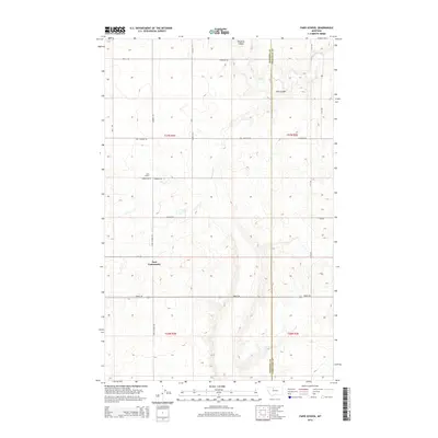
2014 Map of Faris School
USGS Topo · Published 2014About this map
East Community and the rural agricultural tracts of north-central Montana are mapped here along the boundary of Pondera Co and Chouteau Co. The landscape is defined by the high, open plains of the Big Sky State, etched by the seasonal drainage patterns of Pondera Coulee and Flat Coulee. This is a region of immense sections and a strict cardinal grid of farm-to-market roads, including Brady Rd and Lytle Rd. The eponymous Faris School remains a focal point for the local history of the township, situated at the junction of Comwel Rd W and Faris School Rd. Named roads such as Stordahl Rd, Hog Johnson Rd, and Ashmoor Rd trace the paths between expansive farmsteads, reflecting the enduring legacy of the homesteading era in the early 21st century.
Find a feature on this map
26 named features on this map. Tap any name to fly to it.
Don’t see what you’re looking for? This feature index may not catch every label — zoom into the map to look around manually.
Map Details
Editions of this 2014 Faris School Map
This is the sole edition of this map. No revisions or reprints were ever made.
Other maps of this area

1886 · Great Falls
USGS Topo · 1:250,000

1920 · Conrad
USGS Topo · 1:125,000

1949 · Timber Coulee
USGS Topo · 1:62,500

1950 · Timber Coulee
USGS Topo · 1:62,500

1950 · Dutton
USGS Topo · 1:62,500

1954 · Great Falls
USGS Topo · 1:250,000

1954 · Shelby
USGS Topo · 1:250,000

1957 · Great Falls
USGS Topo · 1:250,000

1958 · Shelby
USGS Topo · 1:250,000
1967 · Fowler Coulee SE
USGS Topo · 1:24,000