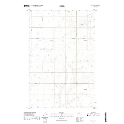
2020 Map of Faris School
USGS Topo · Published 2020About this map
Faris School (historical) marks a former center of community life in this section of the Montana plains, situated along Faris School Rd north of Midland Rd. The landscape is defined by the winding paths of Pondera Coulee and Flat Coulee, which cut through the high prairie terrain. The road network follows a strict sectional grid, with named routes like Stordahl Rd, Hog Johnson RD, and Brady Rd providing access to remote agricultural parcels. The map records the boundary between Pondera and Chouteau counties as it runs north-south through this rural expanse. This 2020 record preserves the locations of local landmarks and family-named roads that characterize the East Community area, offering a precise look at the modern rural infrastructure atop a landscape shaped by historical settlement patterns.
Find a feature on this map
24 named features on this map. Tap any name to fly to it.
Don’t see what you’re looking for? This feature index may not catch every label — zoom into the map to look around manually.
Map Details
Editions of this 2020 Faris School Map
This is the sole edition of this map. No revisions or reprints were ever made.
Other maps of this area

1886 · Great Falls
USGS Topo · 1:250,000

1920 · Conrad
USGS Topo · 1:125,000

1949 · Timber Coulee
USGS Topo · 1:62,500

1950 · Timber Coulee
USGS Topo · 1:62,500

1950 · Dutton
USGS Topo · 1:62,500

1954 · Great Falls
USGS Topo · 1:250,000

1954 · Shelby
USGS Topo · 1:250,000

1957 · Great Falls
USGS Topo · 1:250,000

1958 · Shelby
USGS Topo · 1:250,000
1967 · Fowler Coulee SE
USGS Topo · 1:24,000