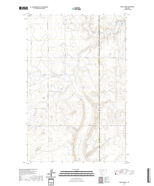
2024 Map of Faris School
USGS Topo · Published 2024About this map
The agricultural grid of the High Plains meets the natural drainage of Pondera Coulee along the border of Pondera and Chouteau Counties. This 2024 landscape is defined by its section-line roads and family-named routes, such as Hog Johnson Rd and Stordahl Rd, which weave through the townships of t27n r2e and t27n r3e. The terrain is marked by seasonal waterways like Flat Coulee and the notable Pondera Coulee, illustrating the geographic transition between the cultivated upland fields and the deep coulee depressions that dictate movement across the prairie.
Find a feature on this map
20 named features on this map. Tap any name to fly to it.
Don’t see what you’re looking for? This feature index may not catch every label — zoom into the map to look around manually.
Map Details
Editions of this 2024 Faris School Map
This is the sole edition of this map. No revisions or reprints were ever made.
Other maps of this area

1886 · Great Falls
USGS Topo · 1:250,000

1920 · Conrad
USGS Topo · 1:125,000

1949 · Timber Coulee
USGS Topo · 1:62,500

1950 · Timber Coulee
USGS Topo · 1:62,500

1950 · Dutton
USGS Topo · 1:62,500

1954 · Great Falls
USGS Topo · 1:250,000

1954 · Shelby
USGS Topo · 1:250,000

1957 · Great Falls
USGS Topo · 1:250,000

1958 · Shelby
USGS Topo · 1:250,000
1967 · Fowler Coulee SE
USGS Topo · 1:24,000