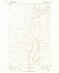
1970 Map of Faris School
USGS Topo · Published 1973About this map
Flat Coulee cuts a deep, winding path through the prairie landscape along the border of Pondera Co and Chouteau Co in this 1970 survey. The map centers on the high-plains social infrastructure of the mid-twentieth century, anchored by the Faris School and the East Community Center. These modest structures, along with the East Community Well, reflect the communal focal points of a sparsely populated ranching or farming district where water sources and schoolhouses defined local geography. A Pipeline and a singular Drill Hole suggest the quiet presence of resource exploration and utility expansion across the open terrain. The topography is characterized by subtle elevation changes and the dramatic incision of the coulees, illustrating how the drainage patterns of the northern Montana plains dictated the placement of roads and remote community outposts.
Find a feature on this map
13 named features on this map. Tap any name to fly to it.
Don’t see what you’re looking for? This feature index may not catch every label — zoom into the map to look around manually.
Map Details
Editions of this 1970 Faris School Map
This is the sole edition of this map. No revisions or reprints were ever made.
Other maps of this area

1886 · Great Falls
USGS Topo · 1:250,000

1920 · Conrad
USGS Topo · 1:125,000

1949 · Timber Coulee
USGS Topo · 1:62,500

1950 · Timber Coulee
USGS Topo · 1:62,500

1950 · Dutton
USGS Topo · 1:62,500

1954 · Great Falls
USGS Topo · 1:250,000

1954 · Shelby
USGS Topo · 1:250,000

1957 · Great Falls
USGS Topo · 1:250,000

1958 · Shelby
USGS Topo · 1:250,000
1967 · Fowler Coulee SE
USGS Topo · 1:24,000